V464 Mtn 24 miles - Forge Valley
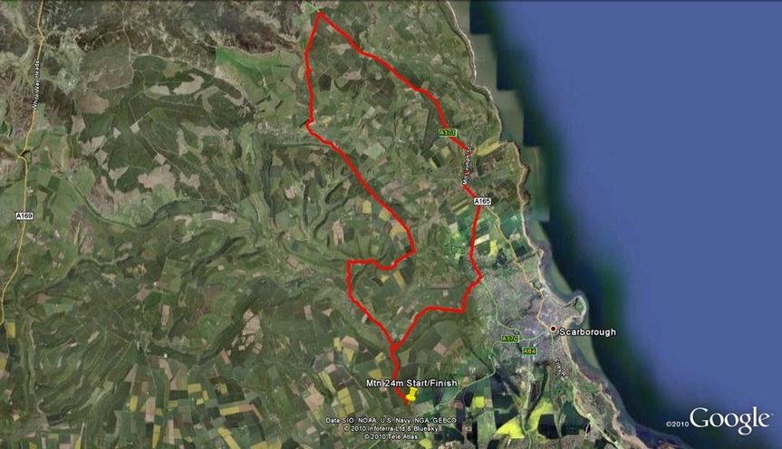
START on unclassified road named Castlegate, East Ayton, southern end of Forge Valley, at stone National Park boundary sign, approx 0.45 miles north of East Ayton (same as for 17m event). Proceed northwards to turn right at bend onto unclassified lane (Lady Edith’s Drive) through Raincliffe woods to Throxenby Mere where take a left onto another unclassified lane (Red Scar Lane). Descend to T junction with Hackness Road where right to Rosette pub and T junction with A171 (4.332 miles). Turn left with care onto A171 and continue via Burniston and Cloughton villages, past the Falcon Inn area to take a left** onto unclassified lane to Harwood Dale (12.031 miles). Follow this road past the Mill Inn to climb Reasty Bank to Suffield where bear right to drop down into Hackness. At Hackness village hall T junction turn left (20.6 miles) past the Everley pub towards East Ayton. FINISH in Forge Valley woods opposite the start point (23.955 miles).
Meeting Point -In Forge Valley at the foot of the steep slope ½m North of East Ayton.
COURSE RECORDS
SENIOR MEN - 1:00:18 - Ben Roberts
SENIOR MEN - 1:00:18 - Ben Roberts
Mountain 24m Alternate Course* - Hackness
*due to temporary traffic lights in forge valley.
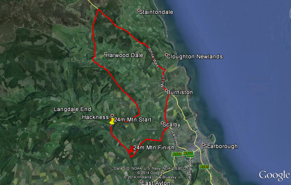
START at Hackness village hall (same as for alternate hilly 10m event). Proceed southwards to end of Forge Valley turn left onto Lady Ediths drive, continue through Raincliffe woods to Throxenby Mere where take a left onto Red Scar Lane. Descend to T junction with Hackness Road where right to Rosette pub and T junction with A171. Turn left with care onto A171 and continue via Burniston and Cloughton villages, past the Falcon Inn area to take a left onto unclassified lane to Harwood Dale. Follow this road past the Mill Inn to climb Reasty Bank to Suffield where bear right to drop down into Hackness. At Hackness village hall T junction turn left past the Everley pub towards Forge Valley again. FINISH on Mowthorpe straight after the farm and bridge.
Meeting point - Hackness village hall.


